Shannine Daniel
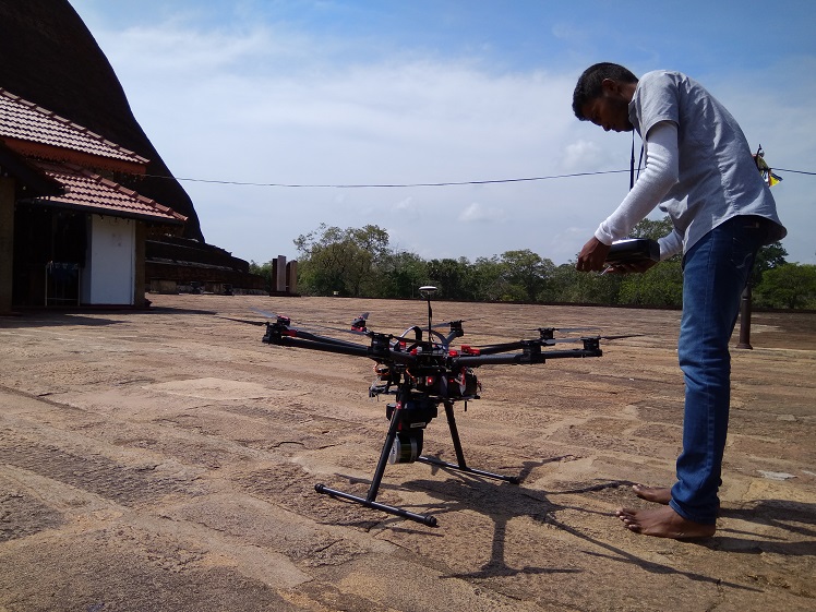
Sri Lanka’s history spans over 2,500 years and its archaeological ruins, historic buildings, ancient artefacts, documents and inscriptions all bear testament to it. But throughout this long period of time, these places and objects have borne the risk of being damaged and even destroyed due to the civil war, pollution, decay and other factors.
Bearing this in mind, a few initiatives have been taken by both the public and private sectors to preserve these valuable sites, objects and documents. Many of these projects and initiatives use digital technology to preserve our island’s rich history and heritage.
3D Mapping To Protect Our Heritage
One such project is the ‘Digitizing Our Heritage’ project. The initial phase of this project took place in the first week of May last year. The project was initially proposed by Dr. Navinda Kottege, a Senior Research Scientist for the Commonwealth Scientific and Industrial Research Organization (CSIRO) of Australia. It brought together members from Sri Lanka’s RCS2 Technologies—a company that focuses on 3D printing and 3D printing machinery—the University of Moratuwa, the Department of Archaeology and, of course, CSIRO.
The objective of the project was to map the most important archaeological sites in the country using Hovermap—a 3D LIDAR mapping system developed by CSIRO.
LIDAR: What It Is And How It Can Help Protect Our Heritage

For the ‘Digitizing Our Heritage’ project, drones were used to carry the LIDAR device around each specific archaeological site. Image courtesy RCS2 Technologies
LIDAR stands for Light Detection and Ranging. It is a remote sensing method that uses light—in the form of a pulsed laser—and other data to generate precise, three-dimensional information.
A LIDAR instrument consists of a laser, a scanner, and a specialized GPS receiver. Airplanes and helicopters are the most commonly used platforms for acquiring LIDAR data over broad areas, and the system allows scientists and mapping professionals to examine both natural and manmade environments accurately.
For the ‘Digitizing Our Heritage’ project, drones were used to carry the LIDAR device around each specific archaeological site. The list of sites that were mapped in the initial phase of the project included: Sigiriya, the Dambulla cave temple, Thuparamaya, Isurumuniya, Mudukondapola, Nikasalanuwara, Kandemedagama, the Galle Fort and a few sites in Polonnaruwa.
Dr Sulochana Sooriyaarachchi, a Senior Lecturer from the Faculty of Engineering at the University of Moratuwa and a consultant on the project team, told Roar Media that the device created a sort of digital map of each site which was then used to create a small-scale 3D printed model.
The ‘Digitizing Our Heritage’ project bore many similarities to the Open Heritage Project which was conducted by Google and CyArk—a nonprofit organisation that deals with 3D laser scanning. With CyArk’s laser-scanning technology, the aim of the project is to collect data from ancient historic and archaeological sites across the world to create virtual models of these sites. So even if a significant historic landmark was damaged or even destroyed, a virtual replica of the site would be accessible online, through a computer or mobile device, or while wearing a VR headset.
While the 3D printed models of these sites created under the ‘Digitizing Our Heritage’ project are helpful to archaeologists, historians, students and teachers, the main objective of this project was to create a sort of digital library with these maps—just like the Google-CyArk initiative. “We felt the need for this project due to the lack of digital records for the archaeological and historical sites in our country. We believe that in the future, 3D models will be even more effective [in Sri Lanka] in many fields such as engineering, education, and archaeology [to name a few],” said Randima Bandara, the Business Development Manager of RCS2 Technologies, who was the project coordinator.
He also told Roar Media that with the success of the initial phase of the project, the team hopes to continue the project. Unfortunately, due to a lack of funds, it is uncertain when this may take place.
Apps To Improve Heritage Tourism
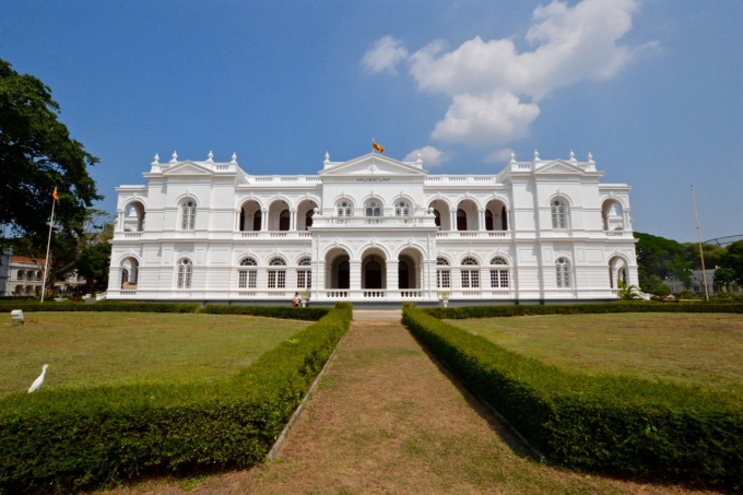
The Colombo National Museum is one of the four museums that are featured on the Sri Lanka Museums App. Image courtesy: atlasandboots.com
Another ongoing project that hopes to contribute towards the preservation of Sri Lanka’s history and culture is the e-Heritage Project. This was initiated by the Information and Communication Technology Agency of Sri Lanka (ICTA) in 2017 to further promote heritage tourism in Sri Lanka, through easily accessible and reliable information.
Speaking to Roar Media Shriyananda Rathnayake, a Programme Manager at ICTA said that the e-Heritage Project was proposed in order to encourage more foreign tourists to visit the heritage sites in Sri Lanka. The project comprises of a heritage application and a heritage content framework for the country.
“Right now the first phase of this project is taking place—the compiling of content about the ancient historic sites in the Polonnaruwa district began after the government approved this project last year,” Rathnayake said
With the heritage app—which Rathnayake hopes will be launched by the end of 2018—visitors to ancient historical sites, will be able to scan the artefacts present in these locations and gain more information. He revealed that each of the artefacts will be given a QR code for this process to take place. The first phase of this project will release a mobile application with content related to the Polonnaruwa district. The next phase of the heritage app will target the districts of Mathale and Galle.
Another project which was undertaken by ICTA—in 2015—was the development of a Sri Lanka Museums App. This project was conducted jointly with the Department of National Museums.
The app is currently available on both the Android/iOS platforms, and it aims to provide visitors to four of the country’s national museums—like the Colombo National Museum—with information about the collections and items on display.
Rathnayake told Roar Media that the app has a variety of functions such as text and voice content in the country’s three most widely spoken languages, and Geo Location Based Augmented Reality—a module to locate the museum’s galleries based on the geo location of the visitor. He also mentioned that in the near future, visitors will be able to use the app to purchase museum tickets online—this feature might be integrated with the Lanka Government Payment Service.
Digitization At The Department Of National Archives
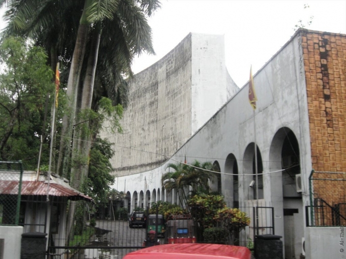
The Department of National Archives has proposed its own digitization projects which are pending approval from the Government. Image courtesy: mapio.net
The Department of National Archives, too, has its own digitization projects going on. The digitization of the Times Collection—one of the national archives’ biggest collection of photographs and newspaper cuttings—is one such project. The information in this collection was first gathered by the Times of Ceylon Press between the years of 1946 to 1985, and spans across various fields of the country’s history—from cinema to sports, politics, economic affairs and cultural and religious affairs. One reason why the department is focused on digitizing this collection is to preserve it for future Sri Lankans, and make it more easily accessible to local and foreign researchers.
Cover: LIDAR Scanning of the Jethawanaramaya Stupa. Image courtesy RCS2 Technologies.