Colombo. The heart of the island. A bustling metropolis filled with both the amazing and the horrendous, depending on when and where you go. Construction is a common sight, with high rises becoming ever more present and the city all out to change its skyline. The port city construction site looms in the distance, its presence known to all but its progress hidden behind fences ‒ a mega project to change the landscape of the centre of the city.
The area which it is situated in is known as either Colombo 1 or Fort, although the latter name is puzzling, as there is almost never mention of any such structure in the area, unlike the infamous Galle Fort in the South, or even the ruined Jaffna and Negombo forts further North. It would seem logical that a fort did once exist, considering that Colombo was the main base for all three Western powers that conquered the island, and yet, why is there never any mention of one? Sri Lanka has been quite adept at preserving historical sites such as the Galle Fort or Sigiriya, so how did this one slip by unnoticed?
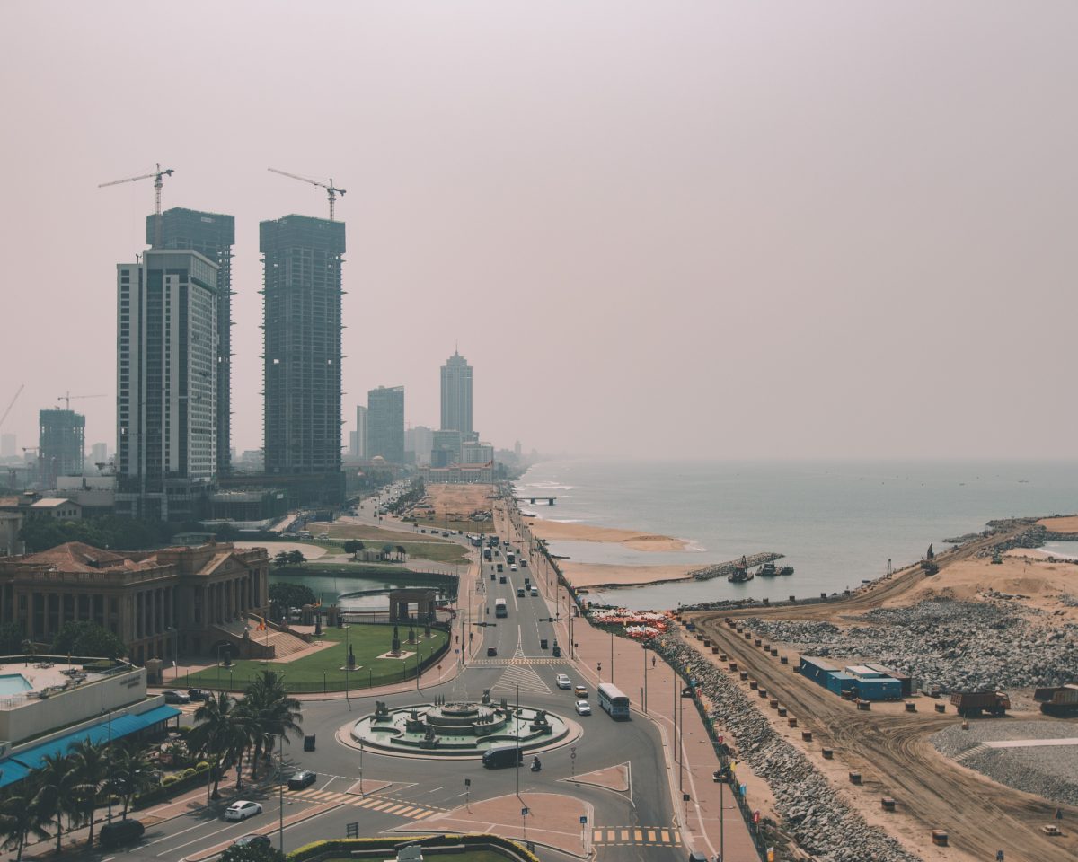
Looking south from the edge of the Fort district, Colombo’s ever rising skyline is littered with construction sites.
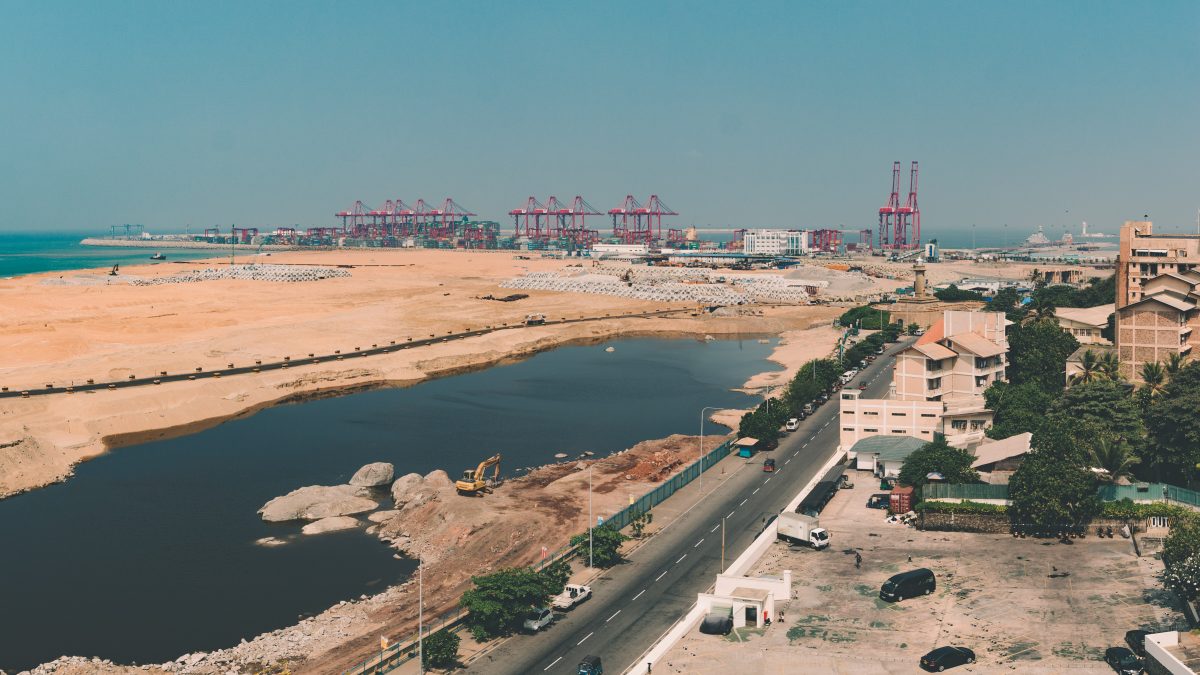
The Port City construction site with the Port in the distance.
The Fort was built initially by the Portuguese, fortified heavily by the Dutch, and finally destroyed by the British. Colombo in the early 16th century was known as Kolonthota to the locals, and was the site of the first landing by the Portuguese. They developed their initial trading post into the fort which was then used as a fortified base and harbour, and defended from threats both from the ocean and inland areas, especially the Kandyan Kings who would lay siege to the Fort.
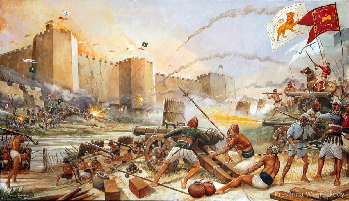
The siege on the Colombo Fort by the armies of King Rajasinghe I, circa 16th century, as reimagined by artist Prasanna Weerakkody.
In 1638, the Dutch and the Kandyan King Rajasinghe II signed the Kandyan Treaty, which was intended to help rid the island of Portuguese rule. The Dutch captured the Colombo fort in 1656 and the fort gained prominence as their centre for administration as they expanded their control of the island. They expanded the fort, demolishing and reconstructing parts of it to defend better from the attacks of the Sinhalese kings and other foreign threats.
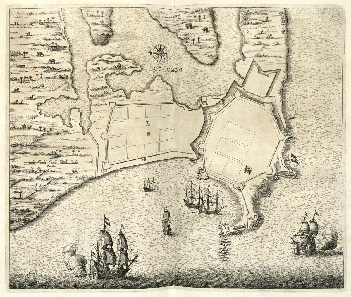
Map of the Fort during Dutch occupation, circa 1672 by Johannes Janssonius Waasbergen.
Supposedly, the British were unaware of the island, until a British Sea captain by the name of Robert Knox landed on the island by chance and was captured by the King of Kandy in 1669. He escaped 19 years later and wrote an account of his stay, thus bringing the island to the attention of the British Empire.
Much later, due to France’s control of the Netherlands after the Napoleonic wars, Britain feared that Sri Lanka might be delivered into the hands of the French. To avoid this, they occupied the Dutch controlled areas on the coastal parts of the islands at the end of the 18th century, and gained control of the other areas through the Treaty of Amiens in 1802, and the fort proceeded to become their centre of administration
Sri Lanka’s sovereignty came to an end in 1815, with the signing of the Kandyan Convention. The agreement was signed on the 10th of March between the British and the Chiefs of the Kandyan Kingdom, deposing the last King of Sri Lanka; Sri Vikrama Rajasinha, and with him over 2,300 years of Sinhalese monarchy on the island. The island was incorporated into the British Empire and became British Ceylon with George III as its monarch.

Demolition of the Dutch Fort, Colombo, c.1865. Image courtesy imagesofceylon.com
After the convention, the inland threats subsided and the British no longer needed a fort. They continued to use the area as the centre of their administration, but destroyed the walls of the fort in 1870, considering them an obstruction to their planned urban development. They demolished most Dutch buildings and replaced them with their own designs, visible to this day in the old parts of town such as the Cargills building.
Interestingly, one building which traces its origins to the Dutch is the residence of the Dutch Governor. Following British occupation, it was home to the British Governor and was known until 1972 as the Queen’s house. Now, it’s used as the official residence for the President of Sri Lanka.
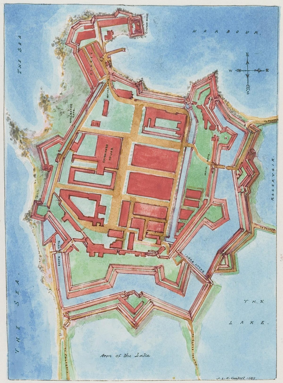
Map of the Colombo Fort after British occupation, circa 1888, drawn by J. L. K. van Dort.
The hunt for the remnants of the Fort leads one on a journey through the city. They are spread out, and only two are publicly accessible. The first remnant is hidden within the Commercial Bank premises on Bristol Street. Restored and maintained by the bank as a condition for being allowed to construct their offices, the structure is only noticeable if one walks into the premises or is looking inside while passing the premises.
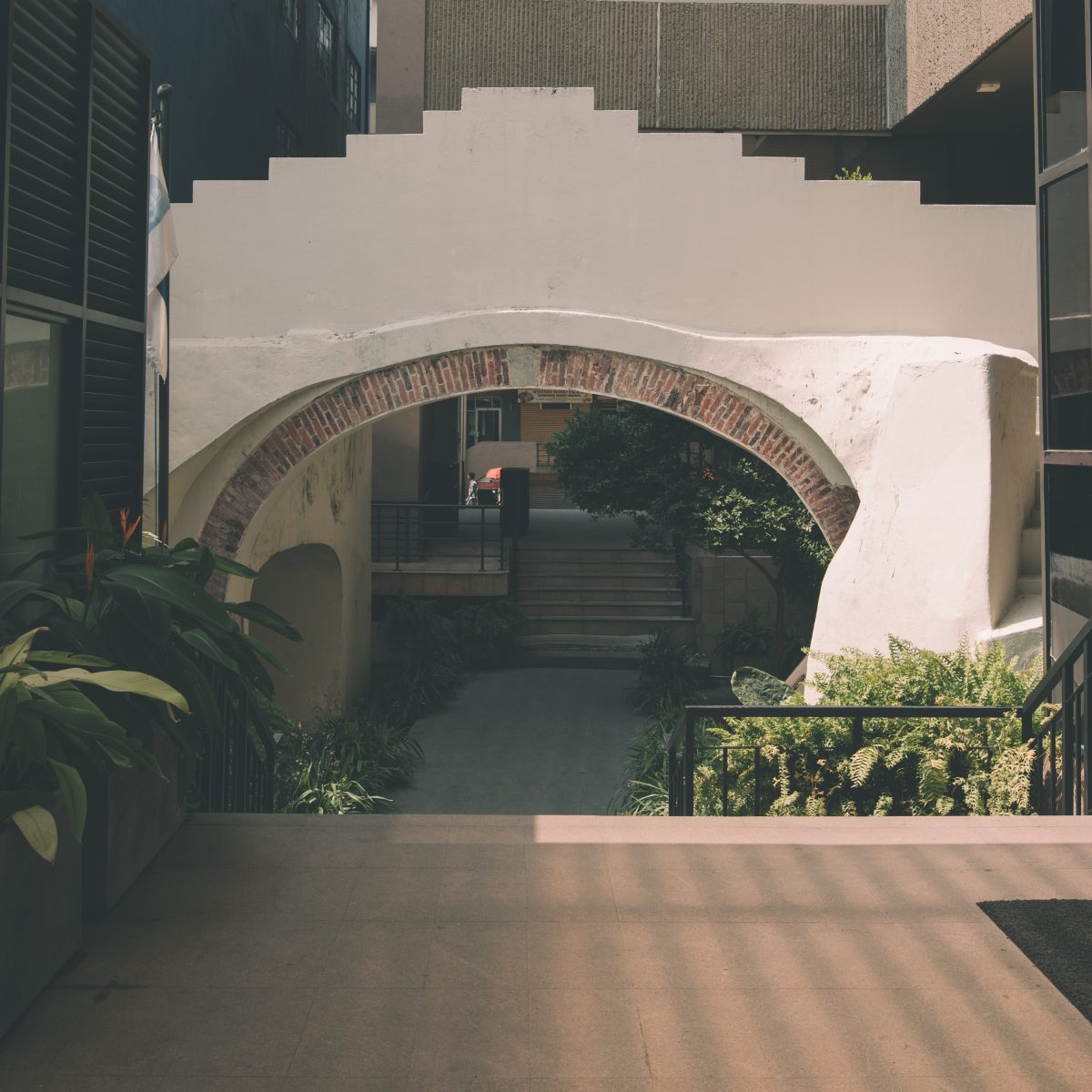
The Delft Gateway, wedged between modern buildings, is easily missed by anyone simply passing by.
It stands alone and unremarkable, an oddity sticking out from its modern surroundings. It seems too small to have been the main entrance to a fort, yet the information plaque nearby confirms it. It remains one of the few structures built by the Dutch and ignored by the British as they destroyed the ramparts to build their administrative buildings.
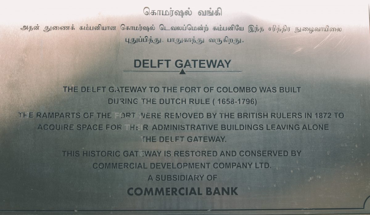
Very limited information is provided by the plaque.
Interestingly, contained within this structure is an emblem, intricately designed and embossed into wood, a depiction of a tree with a crown placed on top. No information on its origin or meaning is provided.
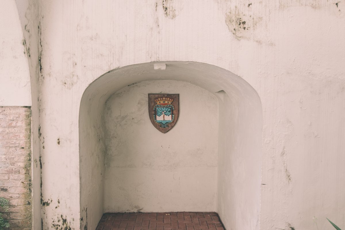
The emblem depicts a tree surrounded by a design and topped with a crown.
Only upon visiting the Maritime museum in the Galle Fort can one find the meaning to the plaque. A large display with multiple emblems and a map of the country stands on the upper floor of the museum. The emblems are in fact the coat of arms for various cities around the country, each known to have contained a fort during Dutch rule.
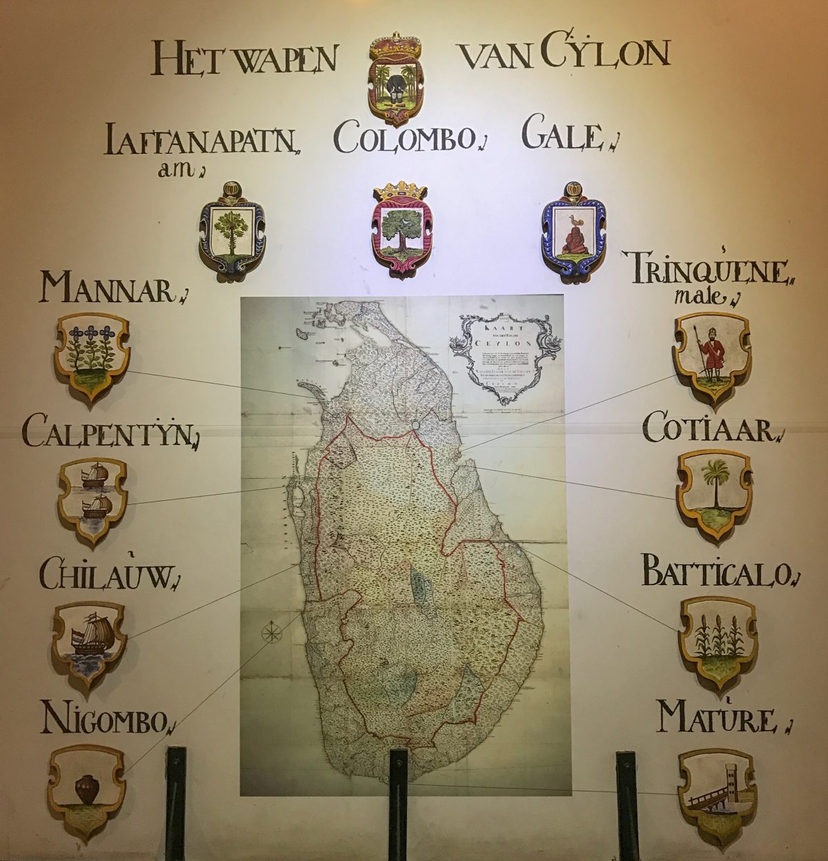
Dutch names and emblems for various cities in Sri Lanka. From left to right: Negombo, Chilaw, Kalpitiya, Mannar, Jaffna, Colombo, Galle, Trincomalee, Muttur (formerly known as Koddiyar), Batticaloa, and Matara.
The Colombo coat of arms depicts a mango tree, and is an evolution of the former Portuguese coat of arms for the city, which also depicted the tree. Ask around, and many theories on the origin of the name “Colombo” can be found. Some say that the Portuguese derived it from the Sinhalese name “Kolon thota”, which means “port on the river Kelani”, another belief suggests that the name comes from the word “Kolamba”, a word used by the early Sinhalese to describe a ford or harbour. The one which fits the coat of arms best, however, is the belief that the Portuguese simply named it after the abundance of mango trees surrounding the port at the time, deriving it from the Sinhalese phrase “Kola-amba-thota” which means “Port of the Mango trees”
Set off to the side and behind the gateway, almost hidden and blending in with the gateway, is a stone block with the year 1854 inscribed on it. The ramparts and walls of the fort were supposedly only destroyed in 1870, making the significance of the year as well as the origin of the block unclear.
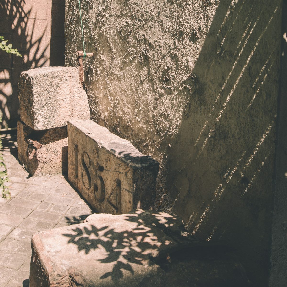
A stone block with the year 1854 inscribed on it, significance unknown.
The search for the second structure leads one into the heart of Pettah, appropriately named and derived from the Tamil word pettai, an Anglo-Indian word used to describe a suburb outside a fort, and the Sinhalese equivalent phrase is pita-kotuwa. Amidst the sea of people, merchants, and three wheelers, it can be quite the challenge to find the right corner. The sought out structure is a bell tower, one that supposedly marked the area for one of the Eastern gates of the fort. Known as the Kayman’s Gate Bell Tower, it stands forgotten and forlorn on the corner of 4th Cross Street and Main Street. Hidden behind a tall mesh fence, it is preceded by a rubbish dump and some electrical infrastructure. The bell and its head lay adorned with the faeces of various birds and an odd plant seemed to be growing out of the top of it.
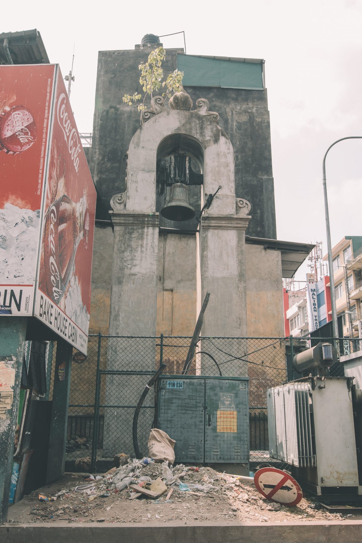
Kayman’s Gate Bell Tower – a name derived from the word Caiman, which means alligator, due to the common presence of crocodiles in the Beira lake at the time.
Behind the fence lies a surprisingly dense information plaque compared to the one at the Delft gateway, with information on the fort, its inner and outer walls, its name, as well as its origins, inscribed. It was, however, covered in what I assume are various liquid stains from either trash or birds, and can be hard to read due to the small font and its position behind the fence.
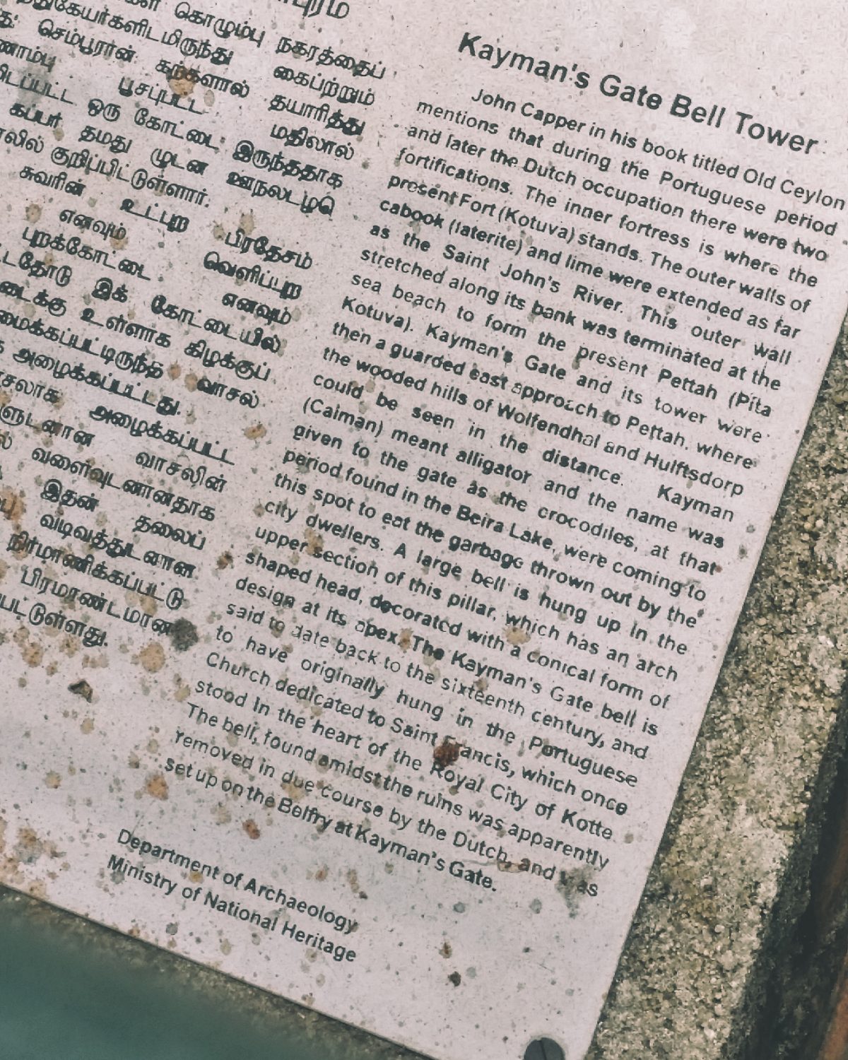
The information plaque for the bell tower.
The final remnant of the fort proved to be the hardest to find. There were murmurs online of a section of the rampart still intact somewhere inside the premises of the port; however, photographs proved impossible to find online. Climbing the Sambodhi Chaithya, the stupa on stilts near the Colombo Lighthouse, supposedly allows one to see the ramparts, but without prior knowledge of what to look for, it is very difficult due to the modern wall it hides behind.
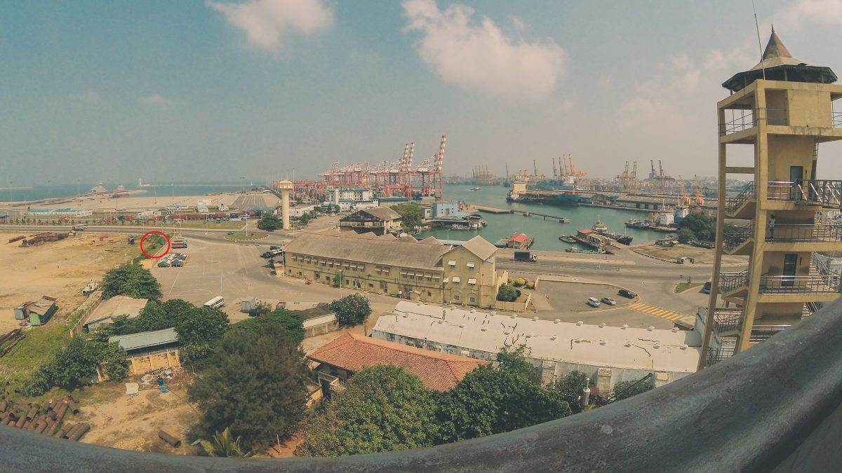
Location of the surviving rampart as seen from the Sambodhi Chaithya temple on Chaithya road, marked in retrospect after accessing the port.
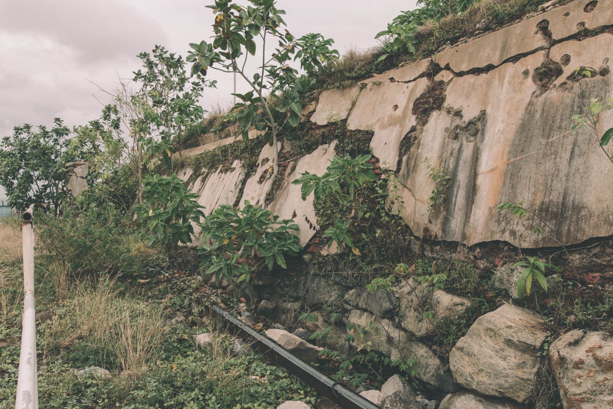
Through a contact, access to the port was granted, on the condition that it be supervised and that no part of the port would be included in the photographs. Escorted by two members of the Navy, a short walk leads to the unassuming wall encircled in the above image. It’s easy to wonder if you were misunderstood, and that you were being taken somewhere completely irrelevant, until you realise that the rampart exists on the other side of the wall, hidden from most lines of sight.
The rampart stands alone and desolate, covered in overgrown shrubs and foliage, with the plaster cracked and crumbling. Various small construction and garbage leftovers are strewn around the area, and a corroded bar is in place to (we assume) prevent people from approaching it, although it begs the question as to who exactly it’s meant to keep away, since no one is allowed inside.
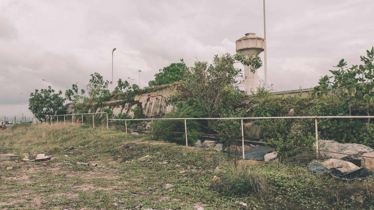
The only remaining section of the ramparts.
A stark contrast to its sister Fort in the South.
The ramparts were the final stop, and signified the bittersweet conclusion to the search for the Fort, or rather what was left of it. On one hand, it was the conclusion of a quest that led around the city, a city whose history just got a little deeper and more colourful, but on the other hand, was the disappointment felt at witnessing the state of these relics, the need for more information than what was available, and a desire for more significant remnants, to better visualise the extent of the Fort as it once stood. The feelings were contradictory; were the remnants well preserved and easy to find, there would be no sense of accomplishment or discovery to end the day with, so perhaps contentment should be found in bringing these relics ever so slightly out of the shadows and back into the awareness of whomever may read this article.